Earthquakes: Integrated approach for the safety of historical-architectural heritage
7/3/2019
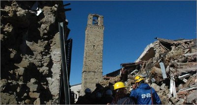
From approximately one hundred inspections conducted by the researchers of the Agency, together with the officials of the Ministry for Cultural Heritage and Activities, it has emerged that in Abruzzo, Lazio, Marche and Umbria, 45% of the churches evaluated was unfit for use, 13% fit for use with remedial works, 5% partially fit for use and 4% temporarily unfit for use. As regards the municipal territory of Amatrice 20 churches out of 21 were unfit for use.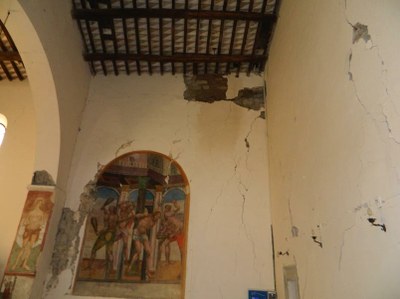
With regard to the activities of the Earth Observation System, ENEA's innovative system consists of a digital map that combines the analysis of a satellite image - which by itself allows the comparison of post-earthquake images with pre-earthquake ones - with a process of interpretation and integration of spatial and spectral information, which provides an overview of the general situation on large areas and short intervals, as well as accurate information on the different types of rubble and collapses.
"The images of the whole historical center of Amatrice were processed in different combinations of spectral bands; the satellite data was further processed, working on the histogram of the image that allowed to highlight the morphological information” Francesco Immordino of the ENEA Laboratory of "Technologies for the Dynamics of Structures and the Prevention of Seismic and Hydrogeological Risk” pointed out said.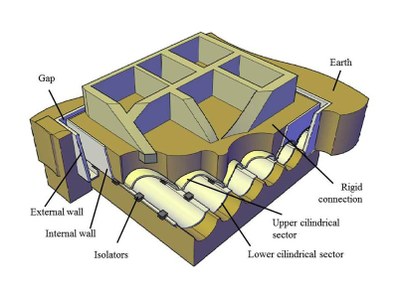
"Moreover, by observing the portions occupied by rubble, high reflectivity and non-homogeneous average tones can be noted, and the high-detail images allow to see total and partial collapses, thus distinguishing the rubble and the types of collapse. Thanks to satellite and optical techniques, radar remote sensing, or SAR, and early warning systems, these technologies can be a valuable tool for prevention, pre and post event territorial planning and for overcoming emergency situations ", Elena Candigliota, researcher at the same ENEA laboratory, explained.
In the central area of Amatrice, made inaccessible by the destruction of almost all buildings, the great historical, artistic and cultural heritage preserved over the centuries in places of worship- made of valuable elements such as frescoes, stuccos, sculptures and furnishings- was also damaged, showing the great fragility of this type of construction and the violence of the earthquake.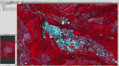
"The reduction of the vulnerability of cultural heritage must necessarily take into account the respect and preservation of the artistic and historical features of the work", Concetta Tripepi, ENEA researcher, pointed out. "It is essential, however, to recognize the fragility of these buildings and provide for measures aimed at ensuring an adequate level of seismic improvement, with interventions guaranteeing the conservation of the architecture in all its forms, consolidate the structural elements, ensure a suitable stiffening of the wooden floors, contrast the thrust of the roofing and improve the connections between the orthogonal walls and between these and the horizontal ones. Only under these conditions is it possible to guarantee the protection of the occupants and the preservation of the property itself ", Tripepi continued.
The results of the studies have provided new ideas and proposals for the prevention and structural improvement of the historical heritage and the management of the territory affected by the earthquake, starting from a seismic isolation system to be placed under the foundation, patented by ENEA and the Polytechnic University of Turin, capable of ensuring safety and conservation of the asset. "It would also be useful to have a preventive record of the buildings protected, containing useful information to be used in emergencies, allowing a faster and more informed process during the verification phase of the immediate post-earthquake", ENEA researcher Giacomo Buffarini concluded.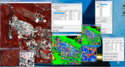
For more information please contact:
Massimo Forni, ENEA – Head Laboratory “Technologies for the Dynamic of Structures and the Prevention of Seismic and Hydrogeological Risk”, massimo.forni@enea.it
Video of Accumoli and Amatrice
[1] http://www.sigeaweb.it/documenti/gda-supplemento-1-2018.pdf

