Environment: First mapping of natural ecosystems in Central Europe by EU project MaGICLandscapes
15/11/2018
Natural and semi-natural ecosystems cover 60% of the 100 million hectares of Italy, Austria, Germany, Poland and the Czech Republic, mapped by the EU project MaGICLandscapes with the ENEA participation
ENEA and the other nine partners of the European project MaGICLandscapes have created the first trans-national map of green infrastructures in Central Europe. It has emerged that on an area of 100 million hectares among Italy, Austria, Germany, Poland and the Czech Republic, natural and semi-natural ecosystems cover 60 million hectares, equal to 60% of the territory/LAND. In Italy ENEA has validated the map for the Po River Park in the Piedmontese stretch between the provinces of Alessandria and Vercelli.The "green and blue infrastructures" on the 60 million hectares of the examined area are made up of woods, grasslands, lakes and rivers by 70% and of semi-natural areas such as urban green and some types of agricultural territories/LAND for the remaining 30%. The mapping, on the other hand, highlighted the total absence/COMPLETE LACK of natural ecosystems essential for the safety of the territory and the quality of the environment, on over 40 million hectares, equal to about 40% of the territory, due to reasons linked to urbanization and intensive exploitation for production purposes. .
As for the Po River Park, ENEA has identified the natural and agricultural areas on the 14 thousand hectares of the territory, contributing to the 'health' of the environment thanks to essential ecosystem services such as air and water purification, supply of food and wood, reduction of erosion and flood risk, biodiversity conservation and regulation of the microclimate, hydrogeological cycle and nutrients. "We have made a very detailed mapping, classifying green rice fields and oak forests as green infrastructures, but not poplar groves, although widespread in the Po Valley. The reason lies in the fact that the rice fields, despite being intensive cultivations like poplar groves, have cycles that 'simulate' marsh environments or lake shores, giving the possibility to numerous animals such as invertebrates and amphibians to live there or to find food, as in the case of herons and waders. The poplar grove, on the other hand, is an intensive cultivation but not a wooded area, which requires the maintenance of bare soil without undergrowth and a periodic clearcutting ", Simone Ciadamidaro, ENEA researcher of the Biodiversity and Ecosystem Services Laboratory, explained.
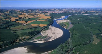
Made with field surveys and cartographic data provided by the Regione Piemonte and Parco del Po Vercellese-Alessandria, the analysis of ENEA researchers highlighted the role of the river as an essential ecosystem for the territory, despite intensive agriculture and the presence of productie activities and residential settlements. In particular, the stretch of the Po between Turin and the confluence with the river Ticino was identified, together with the main tributaries, as an ecological corridor of 120 kilometers between the Alps and the Apennines. "In the 90 kilometers that we examined, we found a varied wealth of flora and fauna related to the river and a good natural dynamism, with the presence of meanders, intertwined canals, gravel and dead branches. These characteristics guarantee the safety of surrounding and downstream territories, because they allow the dispersion of the water mass during exceptional floods ", Maria Rita Minciardi, ENEA researcher of the Biodiversity and Ecosystem Services Laboratory, explained. "However, in other parts of the Po, the exploitation of the land for agricultural, industrial and residential purposes has compromised this hydro-morphological dynamism typical of a great plain river. The task of MaGICLandscapes will be identifying the most appropriate scientific and legislative tools to protect and increase the green infrastructures of the territory, essential for the mitigation of climate change and the conservation of habitats of wild flora and fauna ", Minciardi concluded.
In addition to mapping, the first objective achieved by the three-year project, ENEA and the City of Turin, the other Italian partner of MaGICLandscapes, have also created an inventory of national laws and policies on green infrastructures. The next step for the researchers of the Agency will be the definition of an evaluation system of the public benefit, such as the reduction of flood and pollution risk, the development of strategies and plans for action for the diffusion and valorisation of green infrastructures at the local level.
For more information please contact:
- http://www.interreg-central.eu/Content.Node/MaGICLandscapes.html
- Simone Ciadamidaro, ENEA - Biodiversity and Ecosystem Services Laboratory, simone.ciadamidaro@enea.it
- Maria Rita Minciardi, ENEA - Biodiversity and Ecosystem Services Laboratory, mariarita.minciardi@enea.it

