
Hydrogeological instability: From Sicily a model for satellite territorial control
30/1/2020
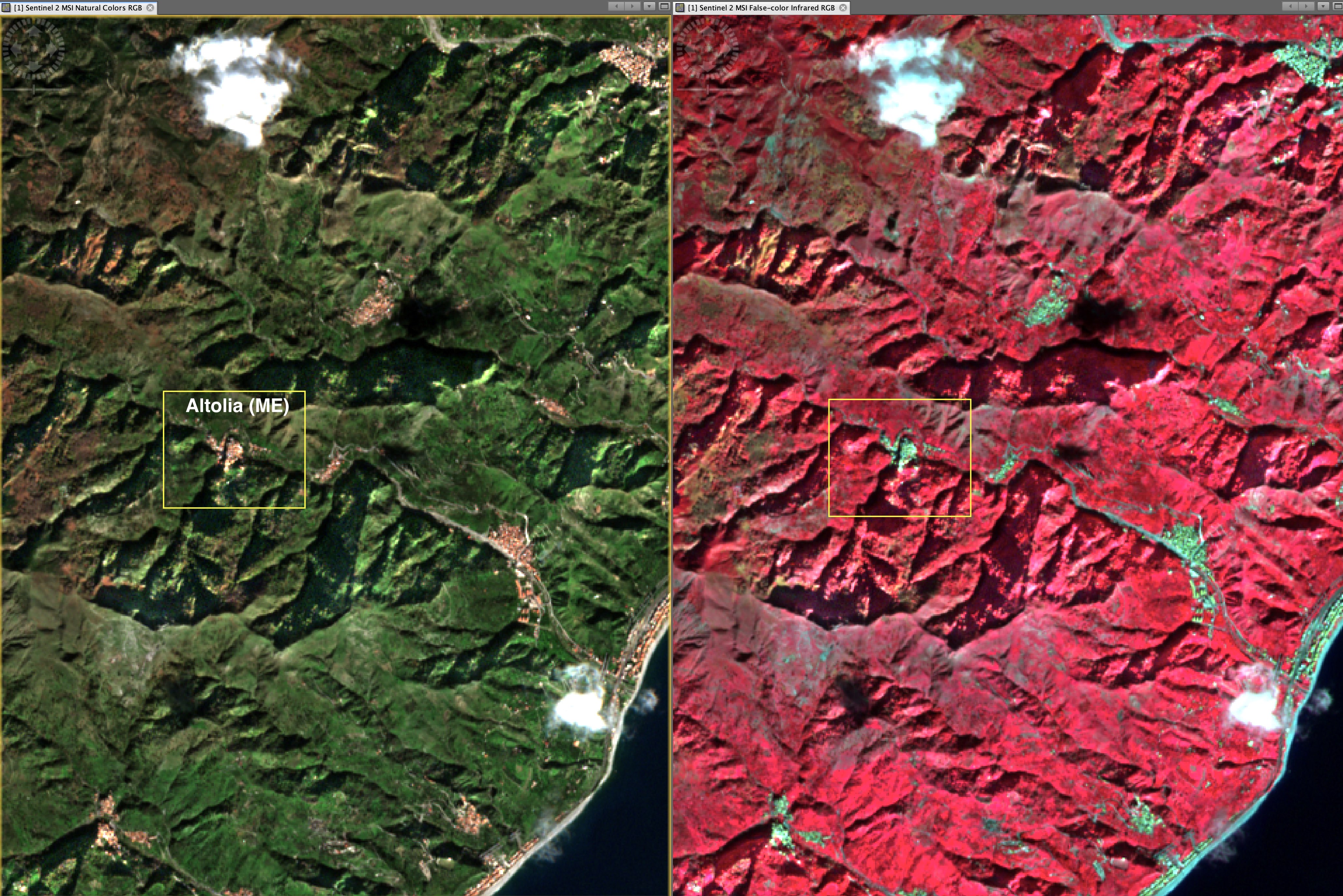
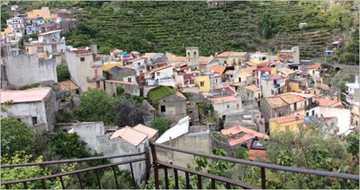 Monitoring hydrogeological instability by means of satellite images provided by the Italian Space Agency (ASI) ‘CosmoSkyMed’ network. This is the objective of the agreement stipulated by ENEA, the company, Planetek Italia, and the Municipality of Messina to ensure protection for the territory of the outlying Altolìa area. Thanks to state-of-the-art satellite technologies, it will be possible to identify new landslides and monitor existing landslides. In addition to ‘real time’ satellite monitoring, the research team will draw up a historical survey (for the period 2014-2018) and a hydrogeological instability forecast up to 2023 for the entire area, (approx. 25 km2).
 In addition, a team of ENEA geologists shall be deployed in the field in order to verify the natural phenomena, to collate the data processed and the satellite images. The research team will use data from the radar sensor fitted on the ‘CosmoSKY-Med’ satellite platform, which is Italy’s major investment in space systems for Earth observation for civil and defence purposes.
Radar signals shall enable measurements to be made at great distances (even hundreds of kilometres) and high definition images of the territory (5 metres), obtained every 30 days, detecting landslip movements even in millimetres plus possible defects of buildings, bridges and viaducts. These images shall then be processed on a geo-information services cloud platform (Rheticus®), by means of a special ‘imaging’ technique thanks to which it is possible to draw up landslide speed maps. “We shall therefore be able to see whether something has changed during the time interval between the various satellite acquisitions and verify and measure with extreme accuracy the deformations of the soil caused by landslides, volcanic eruptions and earthquakes.
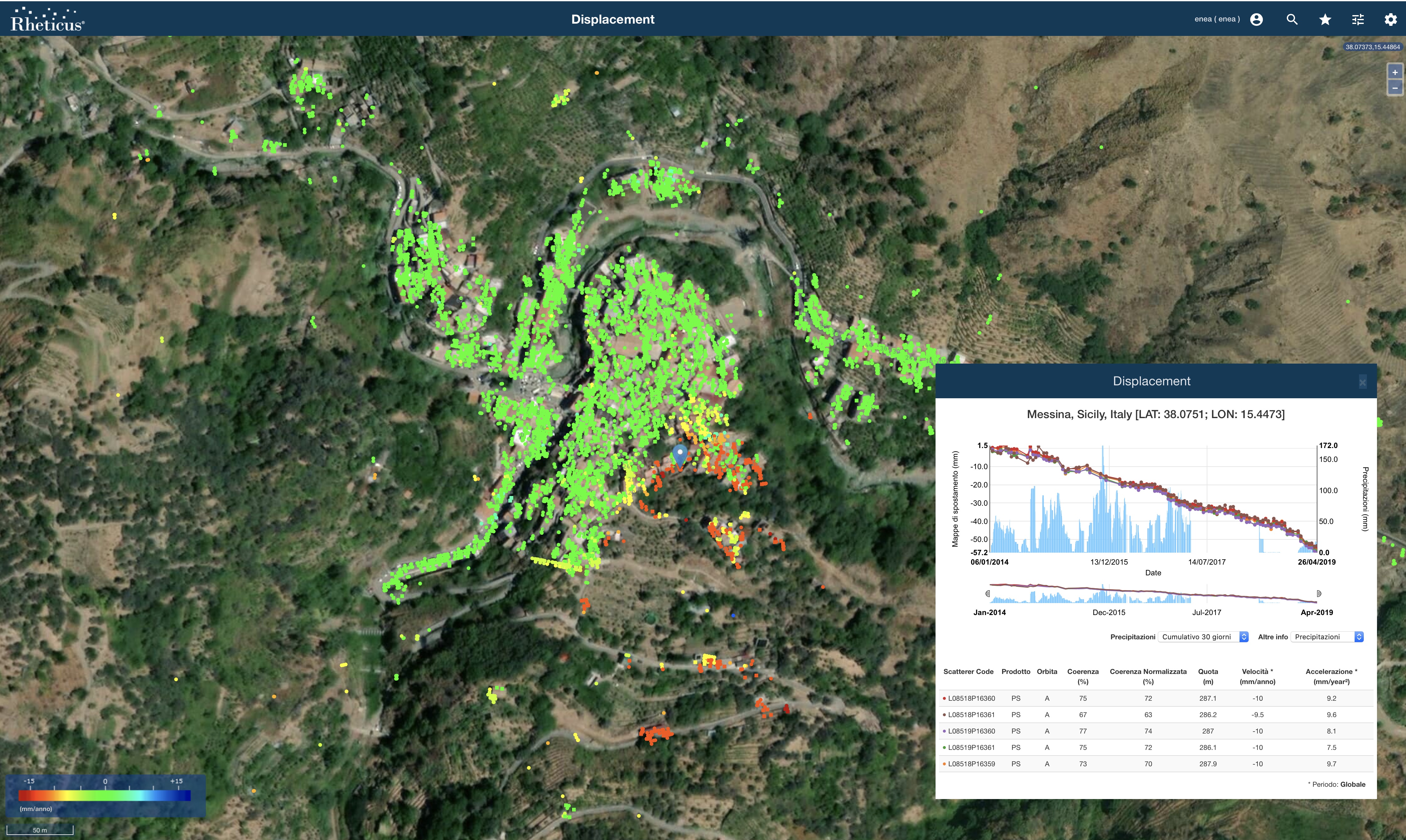 Furthermore, use of satellite data will ensure reduction of the costs of territorial control and effective monitoring of risk areas, thus enabling municipal authorities to implement preventive safety measures”, explains Francesco Immordino, a researcher at ENEA’s “Tecnologie per la dinamica delle strutture e la prevenzione del rischio sismico e idrogeologico” laboratory (technologies for the dynamics of structures and the prevention of seismic and hydrogeological risk laboratory). With satellite monitoring, very large areas can be covered in a very short time: after Altolìa, the municipalities of Messina and Niscemi, in Sicily, shall be targeted. “But this new type of survey, combining satellite and field survey data, aims to become a ‘model’ applicable throughout Italy for control of, and for forecasting, hydrogeological imbalance”, concludes Immordino.
For further information:
Francesco Immordino, ENEA - Laboratorio Tecnologie per la dinamica delle strutture e la prevenzione del rischio sismico e idrogeologico, francesco.immordino@enea.it
Claudio Puglisi, ENEA - Laboratorio Tecnologie per la dinamica delle strutture e la prevenzione del rischio sismico e idrogeologico, claudio.puglisi@enea.it