
Hydrogeological instability: Innovative model to predict risks of ‘rivers of mud’
21/2/2019
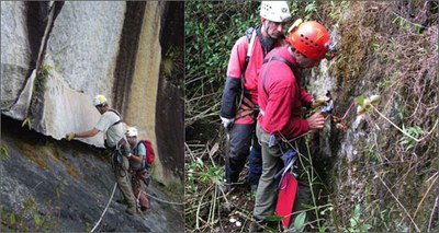 A multidisciplinary team of ENEA researchers has developed an innovative methodology to predict the intensity and path of "rivers of mud", a type of landslide with particularly catastrophic effects, and identify areas and infrastructures at risk. The novelty of the methodology lies in an approach based on cross-checking geographical, historical and territorial data, as well as field studies conducted during the landslides of Messina and on risk mitigation tests conducted in Afghanistan [1] with World Bank funds.
 Another innovative aspect is the attention to "resilient reconstruction" of the areas, also through cost / benefit analysis and training initiatives targeted at the population. The model will soon be applied to a project to be implemented in Peru, in collaboration with the University of Turin and a program for the protection of critical infrastructures in Italy.
"Once made available on the web, the maps we have created will enable public administrations to take action to mitigate damage, also evaluating costs and benefits in a perspective of resilient reconstruction" Claudio Puglisi of the Laboratory of Technologies for Structural Dynamics and Prevention of Seismic and Hydrogeological Risk, pointed out . "Conducting in-depht analysis on the risk from natural events by assessing intensity, speed, transit area and deposit of future landslide phenomena is an important step forward in the defense of structures and infrastructures in locations prone to landslides; it is also fundamental in mitigation strategies of the expected damage, which can become a model to replicate and use in other situations ", Puglisi explained.
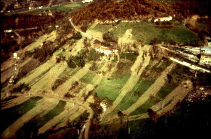
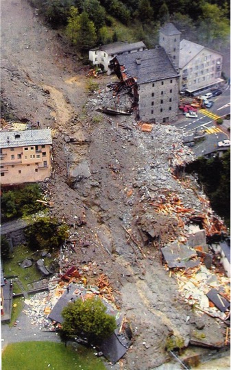 The method adopted by ENEA foresees two levels of in-depth analysis: at the national level, distinct levels of susceptibility are identified for different types of landslides such as slow-moving landslides, like large clay flows typical of central northern Italy or Basilicata; fast-moving landslides, that is, the collapses of rock boulders from vertical walls; fast- moving surface landslides, the so-called "rivers of mud". At the local level and with particular reference to fast-moving surface landslides, which are responsible for the highest number of victims and damage - as it happened in 1998 in the area of Sarno (Salerno) and in 2007 and 2009 in the province of Messina – the areas of possible propagation of the phenomenon and related energies are identified. By crossing such hazard maps with land use maps, it’s possible to identify the areas and infrastructures most at risk.
"The analysis of historical data check-crossed with that of soil, slope, type of rock and other parameters make it possible to identify areas of future landslide phenomena even in areas where they have never occurred”, Puglisi said.
Furthermore, ENEA has designed and developed an ad hoc territorial database and a decision support system, equipped with a WebGIS interface. "In this way, on a case-by-case basis, it’s possible to organize all geographical data and territorial information in an systematic way, making it usable through a specific web application. In addition to allowing mapping and sharing of data and results, this application is essential for providing decision support to the experts of the World Bank and the technicians of the Afghan institutions concerned as end users ", Maurizio Pollino of the ENEA Critical Infrastructure Analysis and Protection Laboratory pointed out.
"The geographical location and years of environmental degradation make Afghanistan a country very prone to particularly intense and recurrent natural hazards such as floods, earthquakes, avalanches, landslides and droughts. In the study financed by the World Bank, it emerged that 70% of the territory of Afghanistan is at risk of landslide. In 2014 vast areas of the country were hit by natural disasters that caused the highest number of deaths in the world for this type of phenomenon, according to data of the last decade", Puglisi concluded.
For more information please contact
Claudio Puglisi, ENEA - Technologies for Structural Dynamics and PREVention of Seismic and Hydrogeological Laboratory - claudio.puglisi@enea.it
Maurizio Pollino, ENEA – Technologies for Structural Dynamics and PREVention of Seismic and Hydrogeological Risk Laboratory - maurizio.pollino@enea.it
Videos are available on request at ufficiostampa@enea.it
[1] In addition to ENEA, the Dutch Deltares (lead partner), the Global Risk Forum of Davos (Switzerland), Deutch Karlsruhe Institute of Technology (KIT) and the Afghan Omran Geotechnical Company have collaborated. The findings were published on the World Bank Report "Afghanistan - Multi-Hazard Risk Assessment, Cost-Benefit Analysis, and Resilient Design Recommendations". Link: https://www.gfdrr.org/en/publication/afghanistan-multi-hazard-risk-assessment